Important measurement method 3D Seismic
3D Seismic is an advanced geophysical method used for detailed exploration of the Earth’s subsurface. This technology generates three-dimensional models of geological structures, enabling precise analysis and identification of suitable well sites.
What is it and how does it work? Seismic surveys
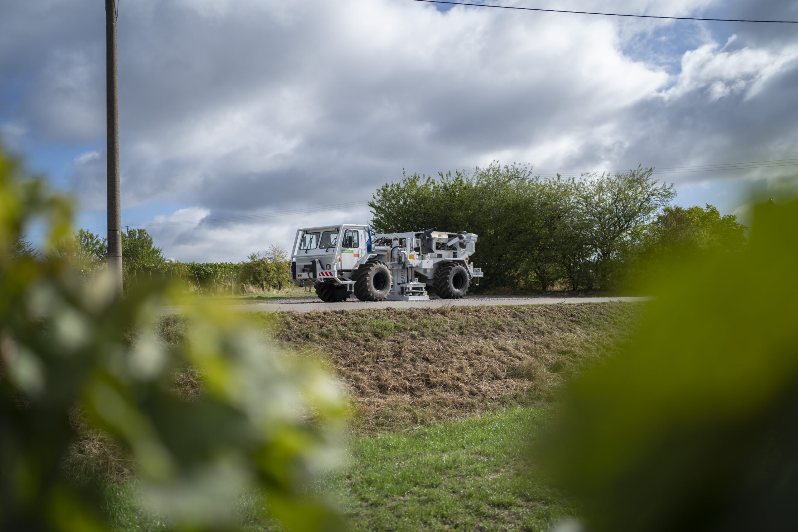
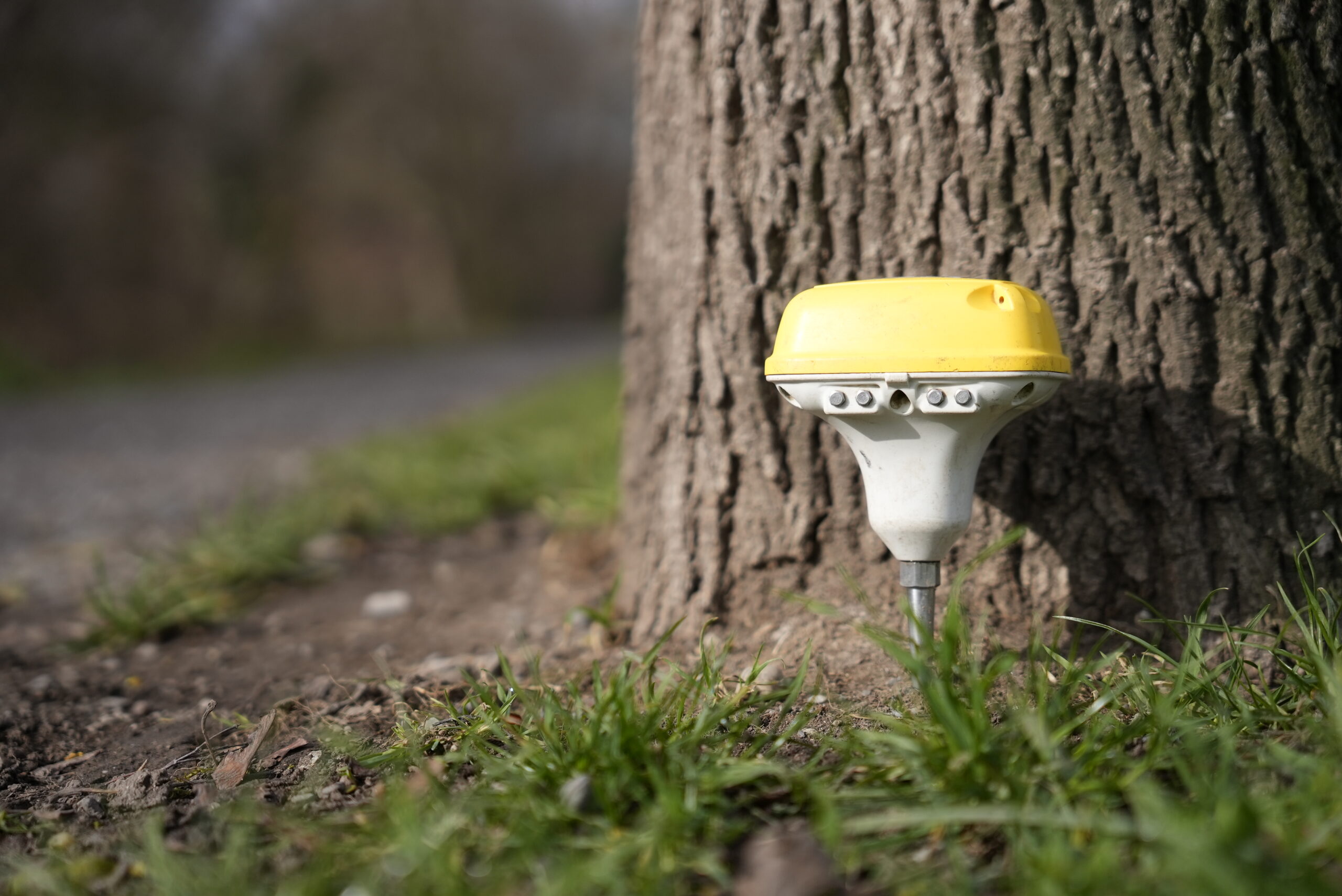
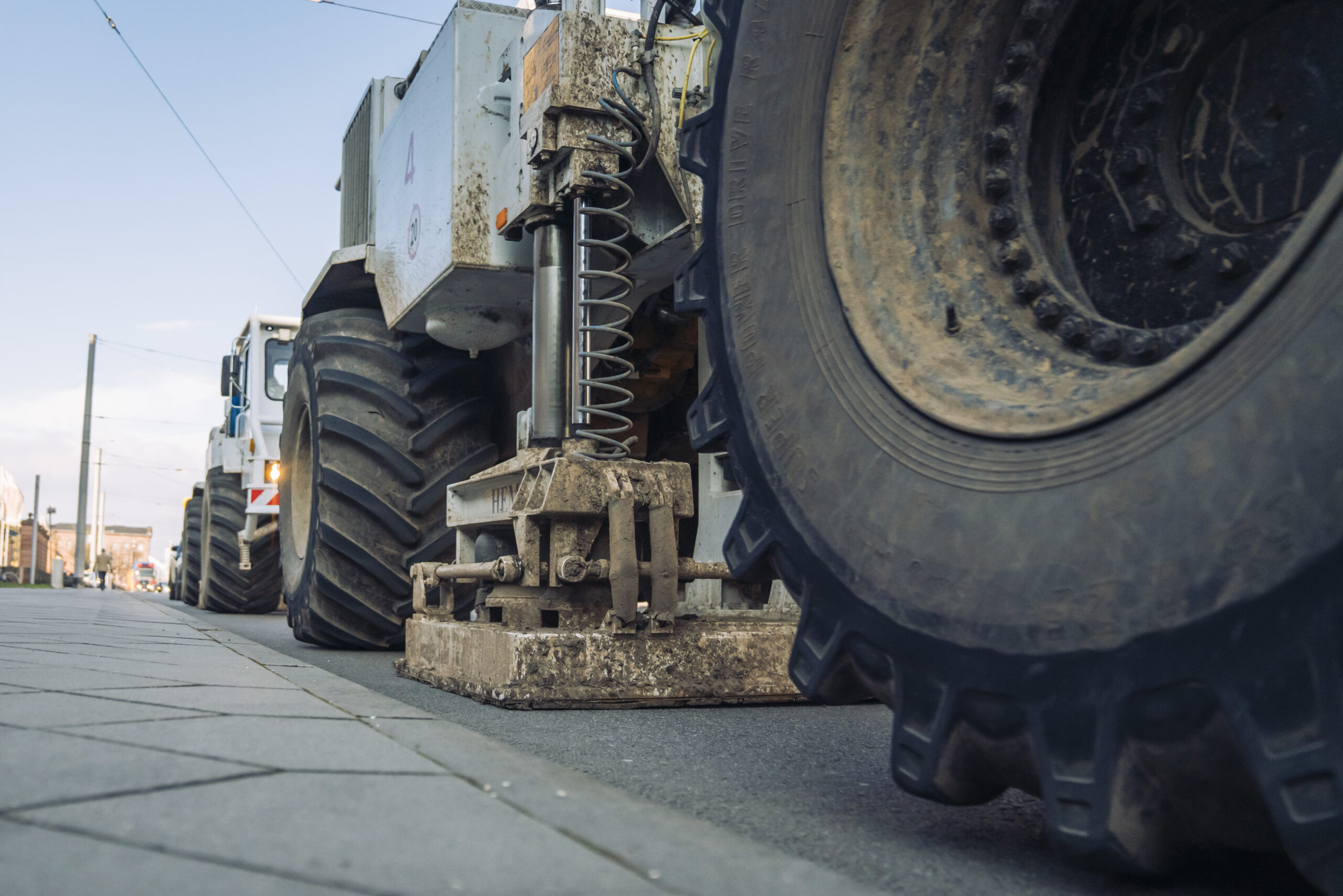
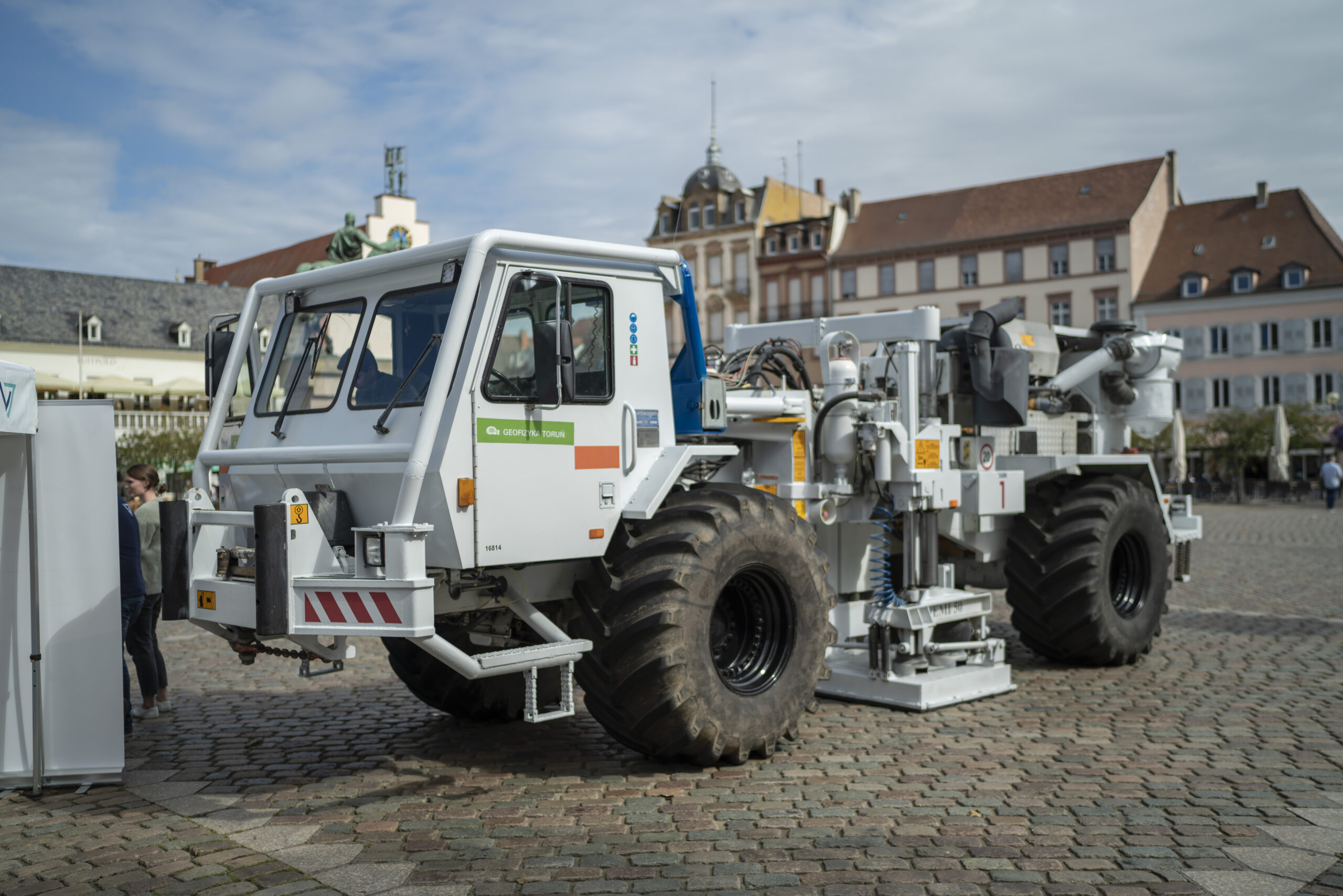
3D Seismic exploration is comparable to a medical ultrasound, aiming to visualise the Earth’s interior without physical excavation. This is achieved by generating sound waves that penetrate deep underground. Specialised vehicles, known as vibro trucks, move across the survey area, producing controlled surface vibrations. These sound waves travel through the subsurface and are reflected by different rock layers. The returning signals are then captured by highly sensitive sensors called geophones, allowing for the creation of detailed geological models.
2D Seismic exploration: The purpose of the 2D seismic survey is to analyse the subsurface along specific survey lines. Based on this data, which already provides information about possible locations, we then define the measurement network for the subsequent 3D seismics. This then provides us with a comprehensive picture of the subsurface, helping us to find the optimal location.
Prior to the 3D Seismic
- Obtaining permits from the Mining Office
- Information and coordination with local authorities, mayors, and municipalities
- Public Relations and community engagement
Conducting the seismic survey
- Permitting (01) – securing permission to access properties and deploying geophones
- Surveying, parameter tests, test lines (02)
- Deploying geophones (03)
- 3D seismic survey (04)
- Retrieval of geophones (05)
- Seismic survey duration depends on survey area and approvals
Post-seismic survey
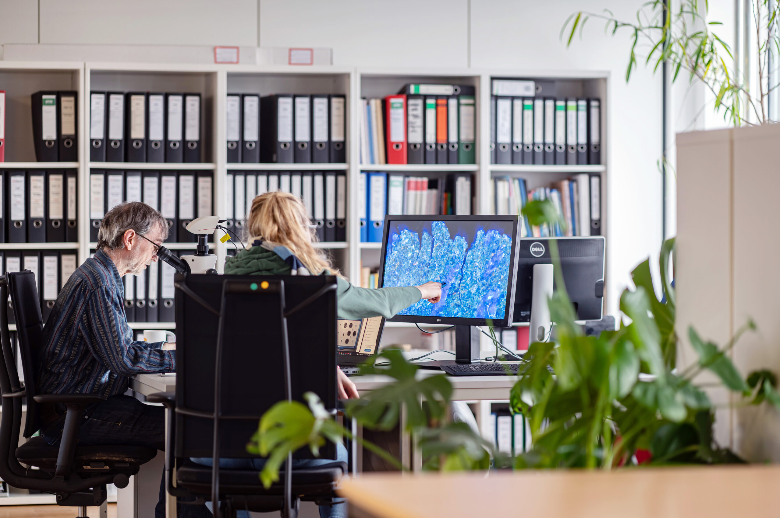
- In-house data processing, evaluation, and interpretation
- Remediation and resolution of issues, e. g., on-field roads by road builders
- Pre-survey phase factors: infrastructure, unexploded ordnance, nature protection
- State authorities receive data for official duties
Does 3D Seismic present any dangers? Ensuring safe investigation
Minor damages resulting from 3D Seismic cannot be entirely ruled out despite all precautions. During seismic surveys, the following types of damage may occur, although unlikely:
- Vibro trucks leave tracks.
- Vibro trucks compact the ground.
- Hairline cracks may appear on the plaster of buildings.
To minimise risks of structural damage, the truck’s vibrations are continuously monitored using vibration monitoring according to DIN 4150 standards, and the risk to the building structure is minimised by adjusting the intensity of vibrations accordingly. In areas with sensitive infrastructure, specific points of stimulation are omitted when necessary.
Learn more About geothermal energy
As part of our integrated project, we use the Upper Rhine Valley’s deep geothermal energy both to provide renewable energy and to produce sustainable lithium. We are therefore doing our utmost to provide information about deep geothermal energy. Here, you can find further interesting links on the topic.
Since 1991, the German Geothermal Energy Association has made an effort to inform the public about all aspects of geothermal energy and deep geothermal energy. Here you will not only find the latest news and exciting key figures, but also relevant questions about geothermal energy in your home, groundwater protection or insurance in the event of damage.
The State Geothermal Research Center has worked with experts from various fields to provide comprehensive answers to many questions on deep geothermal energy. Easy-to-understand summaries and clear illustrations for each area make the program accessible to everyone.
The Rhineland-Palatinate State Office for Mining and Geology can provide special insights into regional geothermal energy and current projects. It also offers services such as the state earthquake service, or explains legislation that is not only essential for us, but can also provide you with valuable background knowledge.